 /A5
/A5digital studio fall 2020
professor margaretha haughwout
A5 due Nov 14 by the end of the day
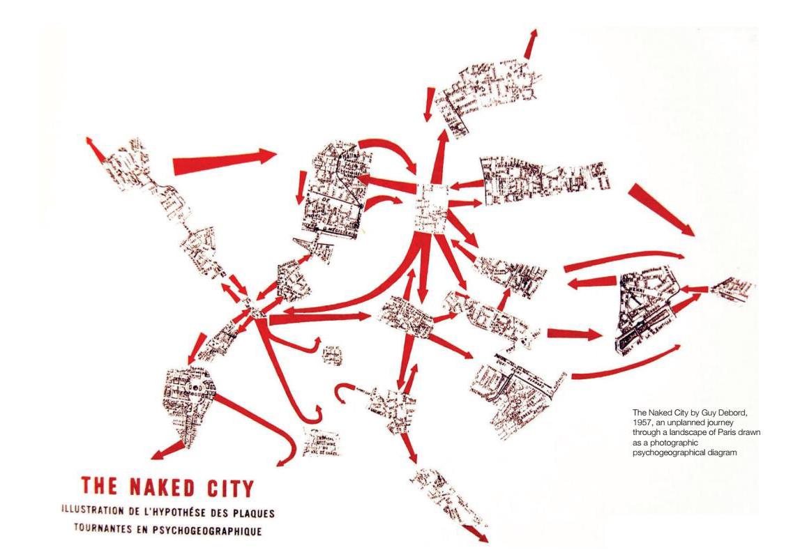
Consider the relationship our bodies have with digital maps, gps navigation, surveillance. Have you ever been lost? When? What did it feel like? Look to the history of artistic practice for ways of thinking about this technology, using the Situationist derive and ideas of psychogeography as a starting place for examining how the built environment and maps determine our emotions and behavior. Using your given lat/long, or your object tied to communication technology as a site for observation, conduct a derive, observing the built naturalcultural environs and how that intersects with your thoughts and feelings.
For /A5, you will make a unique sort of map, using openstreetmap as a starting point: Map One Thing. This "one thing" could be a mood, an object, a history, a landscape, an organism, a plot.
Consider the fundamentals of typical maps: points, lines and areas, as well as legends, titles, scale, north arrows, and citations; will you include these or detourne them into new meanings?
The tension and meaning of the work will come from your ability to juxtapose Cartesian mapping systems and lived experience, what de Certeau differentiates between 'space' and 'place.'
Technically, as stated above, you will use openstreetmap as a base for the project. From here, you might import openstreetmap files into Illustrator for editing (possibly working with SVG data), or work with a geocoding to deepen what's possible for mapping on the web.
To submit: Please share a link to your website on Slack in the #assignments channel
You will be graded on
1) conceptual: unique, artistic approach to a problem
2) perceptual: ability of have your aesthetic/ creative process reflect your concepts (form reflects content)
3) technical: your ability to implement technical lessons into project
...